Foothills Trail
Day 5 - Wednesday, 4 May 2005
Trip miles: 75.3
Wendy was up and hiking before me so I'm hiking solo again. I like hiking solo. I keep seeing her boot prints and the marks from her poles. Not too many, though. Right now I'm writing this in a spot where she rested, I think. I can see a flat spot where she sat by a small rock, and two depressions her boots made. Right by a nice little trickle of water that runs under the trail (that happens a lot out here). Lot's of these little "mini-falls" make this trail interesting.
It's funny how your perspective changes when you're on the trail. Today I dropped a pineapple from my trail mix, and picked it up and ate it. Not because I was hungry, but because I lugged the damn thing 40 miles and I wasn't about to give it to some prissy squirrel who can eat nuts!
And at home, if I get floaties in my water I'll dump it out and get some fresh water. Out here, as long as it's not crawling or big enough to chew, it's fine.

Around 1a last night I got up for a pee, and when I was getting back into the hammock I fell flat on my back! I thought I was holding a layer of the underquilt and a layer of hammock, but it was actually both layers of the hammock, so I slid back and nothing was there to catch me, depositing me solidly on my ass. Skillfully, I rolled onto my back silent as a ninja and made sure Wendy didn't wake up. If she did, I was going to blame it on the wood nymphs. Little bastards.

Where the Faeries live
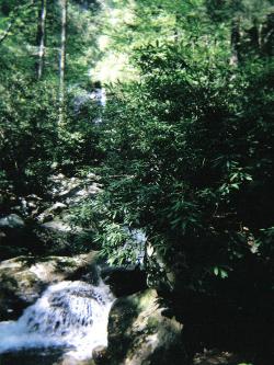
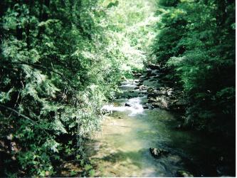
Descending into the Chattooga River Gorge brings quite a change to the trail. This section is very rough and rooty--a whole different trail bed than most of the preceding miles. I saw my first snake on the first descent into the Gorge, too. A 4' cottonmouth was coiled up on the edge of the trail, and as I rounded a switchback he flipped around and was GONE...all I saw was a flash and a few leaves flipping over. I got closer and saw him hiding about 12' down the ridge...big and fat with his zig-zag pattern on his back. Cottonmouths always remind be of baseball bats since they're so bulky. I hung out there for a second to show two young girls hiking shortly behind me with their dog. Best-trained dog I've seen on the trail, and I didn't want him to run off after a cottonmouth! We ooh-ed and ah-ed for a bit, then hiked on down to the river, and the trail paralleled the river for several miles with a few climbs and some AWESOME views. I think the best view was the rock wall across from the campsite at the 90 degree bend that the Guidebook describes. It's like something out of a movie.

Right near the end of the river section, there was a HUGE tree broken over the trail. It was still connected to the stump by a strip about 20-30 feet off the ground, with the main part of the trunk lying on the ground. Slivers splintered from the trunk to the stump at varying heights all the way up so there's really no way through...you just have to go around. Made me realize just how powerful those hurricane winds were.
I had two songs stuck in my head during this segment...whenever I wasn't actually thinking about something (pretty often), I'd find myself about to sing these out loud. First was an adaptation on an old 80s song..."Superfeet, it's Superfeet, she's super freaky."
Next was a country song, and even though I don't care much for country music I thought it was appropriate for a hike: "I'm in a hurry to get things done // Oh, I rush and rush until life's no fun // All I really gotta do is live and die // But I'm in a hurry and don't know why."
So I got to the end of the Chattooga River segment and had dinner at the campsite at the intersection with Bartram Trail, then decided I might just push on and finish my hike today...that would be more than 20 miles, and my first 20-mile day at that! I ate my Stove Top, some Slim Jims, and of course an Oatmeal Creme Pie, picked up my stuff and started hiking. I figured I'd get to the end of this segment and decide then, since camping isn't allowed beyond SC 107.

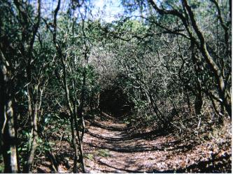
After turning away from the river and ascending Rock Gorge Ridge, it's a soft trail bed of pine needles and forest duff. Heaven under the feet. It was like this for the rest of the trial, and when I got to the last campsite right at the bottom of the stairs leading to SC 107, I decided to push on through.
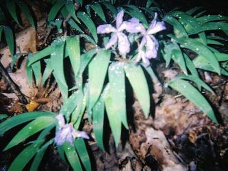
After crossing SC 107, I found an awesome little patch of Flame Azaleas just after the gravel road beyond the highway. (The road is listed at .1 mi on page 54 of the Guidebook.) It was like a tree with a little explosion of fire along its left side...several small blooms adding bright orange pennants to an otherwise nondescript tree in a forest.
Since finishing today required some night hiking, I also got to see the mountain and fresh greenery in the "magic light" of dusk. It's amazing how that light changes everything...I wish I could hike the whole trail in that light.
// Fast forward a few hours //
WOOHOO!! I just finished up my first long distance trail with my first 20-miler!
The book rated both sections as "Easy", and with their math (2.5mph) I should be done in 2.75 hours. That would put me at the trailhead just before 10p. Cool, let's hike. Somewhere along the way, I decided that I was hiking at 3mph, and with that speed I should actually get to the trailhead just after 9p. Don't ask me how that math works out, but that was my thought process at the time...finished by 9:10p or so. So around 9p, as I'm imagining my Jeep just over every rise I see, I find a sign facing the other way. Looking back at it, I read "SC 107 3 mi". What? That can't be right! That means the trail head is another 2 miles. About 50 feet away I see another sign. What does it say? "Oconee State Park 2 mi". I'm thinking I'm almost done, then I find out I still have another hour of hiking on my screaming feet! Talk about a morale killer.
There's an upside, though. I decided I couldn't keep that pace up for another hour (I had been grooving), so it made me slow down and see things I wouldn't have noticed otherwise. Like the city lights twinkling in the distance, or the lightning bug shows. In one drainage, there were about 50 of them up to the ridgeline, and they all stayed on a little longer just for me.
Songs for this section:
- Truckin...down a one-way street
- Wouldn't it be nice if we were closer // The trail wouldn't have to be so long...
So I finally made it to my Jeep at 9:50p, right when my first calculations said I'd be there. I loved the night hiking. As I was writing in my journal and trying to figure out how to get the gate code to get out of the park, a knock on my window scared the living $#!& out of me! Like I just hiked 75+ miles and almost died right there in my car at the end of it. The park ranger was checking to see if I needed the gate code because she drove by and saw my Jeep light on! What a great ending to an awesome hike.
Today's animal count:
- 2 large blackbirds mocking each other...maybe fighting over a girl?
- 4' Cottonmouth
For the trail crew:
- Sloan bridge area could use some trail work--lots of blow downs
- Chattooga River section: along the river could be blazed better. At a few confusing spots, I just picked the fork that looked most traveled and it worked, but I didn't see a blaze for several minutes. One of these was a high-water detour that only had a sign at the West end.